Help
GetInfos
Layers
1. Base Maps
Esri WorldTopoMap
Esri WorldImagery
Esri NatGeoWorldMap
Open Street Maps
2. Satellite ImagesEsri WorldImagery
Esri NatGeoWorldMap
Open Street Maps
MODIS (from 2012) / VIIRS (from 2016)
Landsat 8 (from 2015)
ESRI Landsat True color 15 m
3. Burned Areas MODISLandsat 8 (from 2015)
ESRI Landsat True color 15 m
Burned areas 2003
Legend
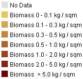 Burned areas 2004
Legend
Burned areas 2004
Legend
Burned areas 2005
Legend
Burned areas 2006
Legend
Burned areas 2007
Legend
Burned areas 2008
Legend
Burned areas 2009
Legend
Burned areas 2010
Legend
Burned areas 2011
Legend
Burned areas 2012
Legend
Burned areas 2013
Legend
Burned areas 2014
Legend
Burned areas 2015
Legend
Burned areas 2016
Legend
Burned areas 2017
Legend
4. Active Fires MODIS
Active fires 2003
Legend
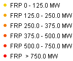 Active fires 2004
Legend
Active fires 2004
Legend
Active fires 2005
Legend
Active fires 2006
Legend
Active fires 2007
Legend
Active fires 2008
Legend
Active fires 2009
Legend
Active fires 2010
Legend
Active fires 2011
Legend
Active fires 2012
Legend
Active fires 2013
Legend
Active fires 2014
Legend
Active fires 2015
Legend
Active fires 2016
Legend
Active fires 2017
Legend
5. Protected areas and districts
Districts
Protected Areas
6. Daily Fire DetectionsProtected Areas
MODIS (all years)
VIIRS 375 m (from 2016)
VIIRS 375 m (from 2016)